Huntington Beach Flood Zones: The Honest Guide (FEMA Maps, Insurance, What Buyers Must Know)
Huntington Beach Flood Zone: Quick Answer
The Huntington Beach flood zone situation is more significant than most buyers expect. Approximately 78% of buildings in the city face some flood risk according to current risk models, and roughly 35% face severe 30-year cumulative risk. FEMA designates portions of Huntington Harbour and low-lying coastal areas as Zone AE and Zone VE — high-risk categories that trigger mandatory flood insurance if you have a federally backed mortgage.
The Huntington Beach flood zone you are in directly affects your insurance costs, your lender requirements, and your long-term resale market. I check flood zone status on every property before we write an offer. Here is everything you need to know to protect yourself.
- FEMA Zone AE / VE: High-risk — mandatory NFIP insurance with federal mortgage
- Zone X (Shaded): Moderate risk (0.2% annual / 500-year floodplain)
- Zone X (Unshaded): Minimal risk — but 20–25% of claims still come from these areas
- NFIP average in California: ~$811/year — high-risk HB areas reach $500–$1,200+/year
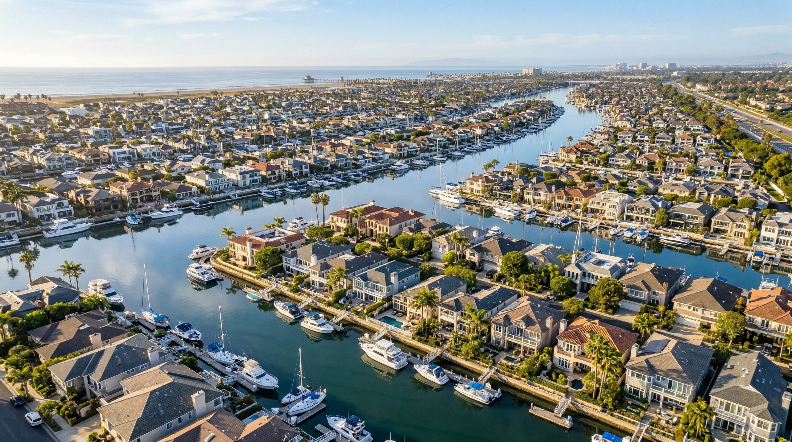
- Huntington Harbour: Highest flood risk in the city due to man-made channels and tidal exposure
Last verified: April 2026 · Sources: FEMA Map Service Center, FEMA National Flood Insurance Program, City of Huntington Beach
✅ FEMA NFIP
✅ City of Huntington Beach
✅ OC Treasurer-Tax Collector
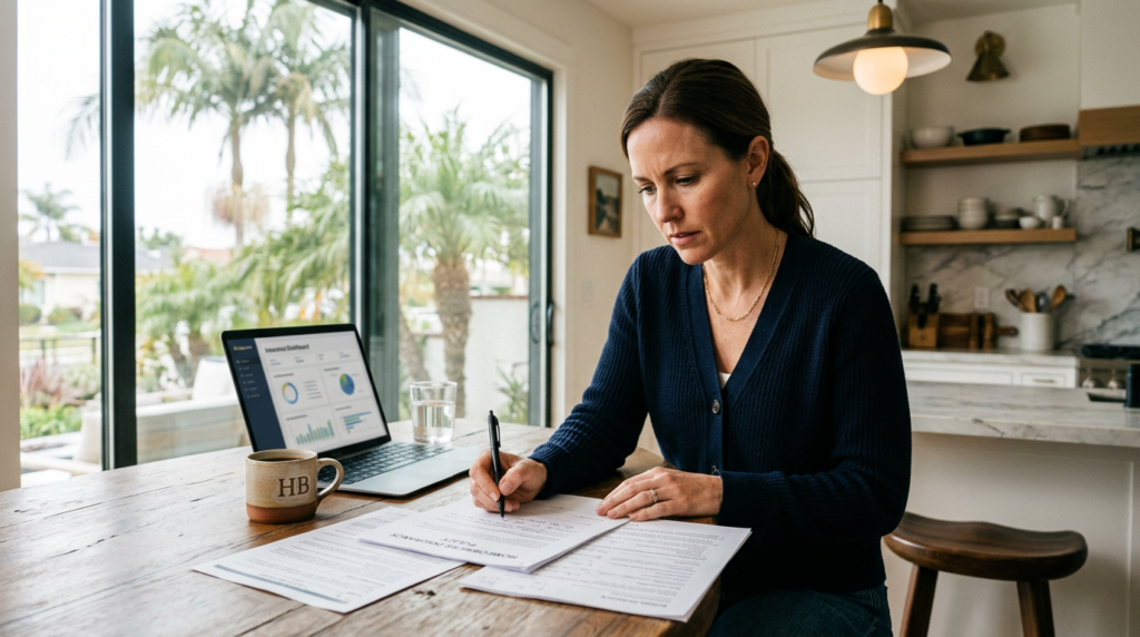
Huntington Beach flood zone questions come up in almost every buyer transaction I handle near the water. This is not a topic where vague answers protect anyone — the wrong flood zone designation can add $1,200 per year in insurance costs you did not budget for, or create a lender requirement that delays or kills your closing.
I check the Huntington Beach flood zone status for every property before we write an offer. Here is the full picture: what the FEMA zones mean, which neighborhoods are highest risk, what insurance actually costs, and how to verify any specific address before you commit.
Huntington Beach Flood Zone FEMA Designations Explained
FEMA’s National Flood Insurance Program uses a letter-based zone system for the Huntington Beach flood zone map. Each zone designation carries different insurance implications and lender requirements. Understanding these codes before you buy is essential.
| FEMA Zone | Risk Level | Insurance Requirement | Annual Flood Chance |
|---|---|---|---|
| Zone AE | High Risk | Mandatory with federal mortgage | 1% or greater (100-year flood) |
| Zone VE | High Risk + Wave Action | Mandatory with federal mortgage | 1% or greater + coastal wave risk |
| Zone X (Shaded) | Moderate Risk | Optional but strongly recommended | 0.2% annual (500-year floodplain) |
| Zone X (Unshaded) | Minimal Risk | Optional | Less than 0.2% annual |
The critical point about Huntington Beach flood zone X (Unshaded): “minimal risk” does not mean zero risk. Nationally, 20 to 25% of all NFIP flood claims come from properties in Zone X. In a city like Huntington Beach where the water table is high and storm drain systems can be overwhelmed, that residual risk is real. I always recommend buyers in Zone X at least price flood insurance before deciding whether to waive it.
Huntington Beach Flood Zone by Neighborhood
The Huntington Beach flood zone picture varies dramatically by neighborhood. Properties a few blocks from the coast may be in Zone X while a home in Huntington Harbour faces Zone AE classification due to its canal-adjacent location. Here is the general Huntington Beach flood zone breakdown by area:
| Neighborhood | Typical FEMA Zone | Key Risk Factor | Insurance Implication |
|---|---|---|---|
| Huntington Harbour | AE / VE (many parcels) | Man-made channels, tidal exposure | Mandatory; $500–$1,200+/yr |
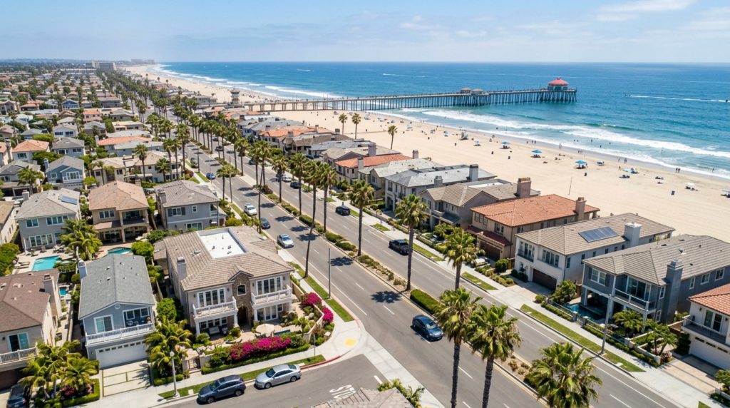
| Downtown HB (beachfront) | VE / AE (oceanfront) | Direct Pacific exposure, wave action | Mandatory; higher premiums |
| Seacliff | X (Shaded to Unshaded) | Elevated bluff location reduces risk | Optional; moderate risk |
| Brightwater | X (Shaded) near wetlands | Bolsa Chica wetland proximity | Optional; verify by parcel |
| Bolsa Chica area | X (Shaded / Unshaded) | Near wetland system | Optional; parcel-specific |
| Southeast HB | X (Unshaded) | Inland, elevated | Optional; low risk |
| Northwest HB | X (Unshaded) | Inland, away from channels | Optional; low risk |
These zone designations are parcel-specific — the table above reflects general patterns, not guaranteed classifications for every address. Two homes on the same street can be in different Huntington Beach flood zone designations depending on their exact elevation and proximity to mapped flood sources. Verification requires looking up the specific APN on the FEMA Map Service Center.
Huntington Beach Flood Zone: What Insurance Actually Costs
The Huntington Beach flood zone insurance picture changed significantly with FEMA’s Risk Rating 2.0 methodology, which took effect for new policies in 2021 and renewals in 2022. Instead of relying solely on zone designation and community-level base flood elevations, Risk Rating 2.0 prices each property individually based on its distance to water, elevation relative to flood sources, structure type, and replacement cost.
The result: some properties in historically high-risk Huntington Beach flood zones saw premiums decrease under Risk Rating 2.0 because their individual attributes were actually lower risk than the zone average. Others in Zone X saw increases because their specific location (low elevation, proximity to storm drains) made them higher risk than their zone suggested.
Current National Flood Insurance Program average premium in California is approximately $811 per year. In high-risk Huntington Beach flood zone properties — primarily in Huntington Harbour and direct oceanfront in Downtown — premiums typically run $500 to $1,200+ per year through NFIP. Private flood insurance may offer lower rates for some properties. I always recommend buyers get a private market flood insurance quote alongside the NFIP rate before closing.
Huntington Beach Flood Zone: Huntington Harbour in Detail
No discussion of the Huntington Beach flood zone is complete without a detailed look at Huntington Harbour. This is the city’s highest flood-risk residential area. The neighborhood was constructed in the 1960s as a series of man-made islands and peninsulas connected by dredged channels. Beautiful, waterfront, and genuinely at elevated flood risk.
Many Huntington Harbour properties sit in FEMA Zone AE, meaning the property has a 1% or greater annual chance of flooding. For buyers using a federally backed mortgage (FHA, conventional conforming, VA), this triggers a mandatory NFIP flood insurance requirement at closing. You cannot close without it.
The insurance requirement in Huntington Harbour’s Huntington Beach flood zone adds a real line item to monthly housing costs. At $1,000 to $1,200 per year, that is $83 to $100 per month your lender will count in your debt-to-income calculation. Factor that into your budget math before you fall in love with a specific property. I can pull the specific FEMA flood zone designation and NFIP estimate for any Huntington Harbour address before you make an offer.
Attention to detail and super friendly!
— Mike Estrada, Google
Huntington Beach Flood Zone: The 78% Risk Statistic Explained
The widely cited figure that approximately 78% of Huntington Beach buildings face some flood risk requires important context. This figure comes from climate risk assessment models that use broader definitions of flood risk than FEMA’s official zone designations. These models incorporate pluvial flooding (rain-driven surface flooding), storm drain overflow, and sea level rise projections over a 30-year horizon.
The Huntington Beach flood zone official FEMA map covers a much smaller percentage of the city in mandatory-insurance zones. The 78% figure represents cumulative risk across all flood types over 30 years — including events that have a very low individual annual probability but a meaningful lifetime probability.
The 35% severe 30-year risk figure is more specifically tied to properties where a significant flood event during a 30-year mortgage term is modeled as having a 35% or greater probability. For buyers with a long-term horizon in the Huntington Beach flood zone, these broader risk metrics deserve attention even when FEMA’s map shows Zone X.
Huntington Beach Flood Zone: Letters of Map Amendment and Elevation Certificates
If you are buying a property in a high-risk Huntington Beach flood zone, two tools can potentially reduce your insurance costs: a FEMA Letter of Map Amendment (LOMA) and an Elevation Certificate. These are worth understanding before you assume you are stuck with the zone designation as listed.
An Elevation Certificate, prepared by a licensed surveyor, documents the property’s exact elevation relative to the Base Flood Elevation (BFE) on the FEMA flood map. If your property sits above the BFE, this can qualify you for lower NFIP premiums or support a LOMA application that removes the property from the high-risk Huntington Beach flood zone.
A LOMA is a formal FEMA determination that removes a specific parcel from the Special Flood Hazard Area designation. If granted, it eliminates the mandatory insurance requirement even if the parcel appears on the flood map. For properties near the boundary of a Huntington Beach flood zone AE designation, this process can save $600 to $1,200 per year. I have worked through this process with clients and can connect you with a qualified surveyor who handles HB flood zone matters.
Gantry dealt with my late brother’s hoarder condo, once cleaned-up, he helped with renovation and improvements that were badly needed and we got a quick sell at a great price. This was critical since I lived in Seattle and southern California.
— Lawrence Fain, Google
How to Verify Huntington Beach Flood Zone for Any Property
Here is the exact process I use to verify Huntington Beach flood zone status for every property before we write an offer. This is something every buyer should do regardless of what the listing description says.
Step one: Go to the FEMA Map Service Center and enter the property address. This pulls the official Flood Insurance Rate Map (FIRM) and shows the specific zone designation for that parcel. Note the panel number and effective date — if the map was recently revised, verify you are looking at the most current effective version.
Step two: Get a preliminary flood insurance quote from a licensed insurer before you remove your insurance contingency. NFIP quotes can be obtained through any licensed insurance agent. For private market alternatives, ask your agent for referrals to flood insurance specialists who serve the Huntington Beach flood zone market.
Step three: Check whether the property has an existing Elevation Certificate or a previous LOMA. The seller should disclose any FEMA correspondence related to the Huntington Beach flood zone status. If they have an elevation certificate, request a copy — it may allow for reduced premiums.
Step four: For properties in Zone AE or VE, request a flood-specific inspection by your home inspector. Beyond FEMA zone status, the physical condition of drainage, foundation type, and ground-floor elevation all affect your real-world flood risk.
Before you write an offer on any coastal property in Huntington Beach, let me pull the FEMA flood zone designation, get you a preliminary NFIP insurance estimate, and identify whether an elevation certificate is on file. This takes about 30 minutes and it protects you from budget surprises at closing. Call me directly or schedule a time.
Call 714-500-7797 or Schedule a Call
Questions Clients Ask About the Huntington Beach Flood Zone
Which Huntington Beach neighborhoods are in a flood zone?
The highest flood zone concentration in Huntington Beach is in Huntington Harbour, where many parcels fall in FEMA Zone AE due to the man-made channels and tidal water proximity. Direct oceanfront properties in Downtown HB may also carry Zone VE or AE designations. Seacliff, Southeast HB, and Northwest HB are predominantly in Zone X (lower risk). Verify any specific address at the FEMA Map Service Center.
Do I need flood insurance if I am buying in the Huntington Beach flood zone?
If you are buying with a federally backed mortgage (FHA, conventional conforming, VA, USDA) and the property is in FEMA Zone AE or VE, flood insurance is legally required before closing. It is not optional. If you are in Zone X, insurance is technically optional but worth pricing. The NFIP average in California runs approximately $811/year — often reasonable protection given the residual risk even in lower-risk zones.
How much does flood insurance cost for Huntington Beach flood zone properties?
Under Risk Rating 2.0, premiums are individually calculated. For Huntington Beach flood zone high-risk properties in Huntington Harbour and coastal areas, typical NFIP premiums run $500 to $1,200+ per year. Zone X properties that choose to carry flood insurance typically pay $400 to $700 annually through NFIP, or less through private flood markets. Get a specific quote for the property address — do not estimate from neighborhood averages.
What is FEMA Risk Rating 2.0 and how does it affect Huntington Beach flood zone insurance?
Risk Rating 2.0 is FEMA’s updated flood insurance pricing methodology, fully phased in as of April 2022. Instead of zone-based flat pricing, each Huntington Beach flood zone property is individually rated based on distance to water, elevation, structure type, and replacement cost. Some properties saw premium decreases; others saw increases. If you are buying a property that has existing NFIP coverage, request the current premium breakdown and verify whether the prior owner’s rate is transferable.
Can I get a property removed from the Huntington Beach flood zone?
Yes, through a FEMA Letter of Map Amendment (LOMA). If a licensed surveyor demonstrates that the property’s lowest floor elevation is above the Base Flood Elevation, FEMA may issue a LOMA removing the mandatory insurance requirement. This is most relevant for properties near the boundary of Zone AE designations. The process typically takes 60 to 90 days and costs a few hundred dollars in survey fees — but can eliminate hundreds of dollars per year in insurance costs for properties correctly removed from the high-risk Huntington Beach flood zone.
What To Do Right Now
Before you tour any property near the water in Huntington Beach, go to the FEMA Map Service Center and enter the specific address. It takes two minutes and gives you the official flood zone designation. If the property is in Zone AE or VE, call a licensed insurance agent immediately and get an NFIP premium estimate — you need that number in your budget before you make an offer, not after your offer is accepted. If the property has an existing Elevation Certificate, request a copy from the seller. If there is not one and you are in a high-risk Huntington Beach flood zone, budget $400 to $600 for a surveyor to prepare one — it may save you more than that annually in insurance. Call me at 714-500-7797 or schedule a call and I will walk through the specific Huntington Beach flood zone designation and insurance implications for any address you are considering.
Get my weekly Market Update: Subscribe here
Gantry Wilson · Broker Associate / DRE# 01412779 · Gantry Wilson Group at Real Brokerage · Serving Huntington Beach and OC since 2004
To explore Orange County real estate: Main Site
To search active listings: Search Homes
To read more from Gantry: Blog